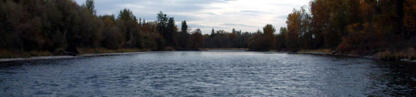
Public Access to the Rogue River - above Gold Ray Dam Site

Introduction: This is meant to point out spots of Public access. They are meant to be places which you will have to explore, not places to park next to the river where you step out of your car, begin casting and catch fish. They are used by the public. It is your responsibility to be alert for people behind you in your backcast. No "people hook-ups", please.
Some are County and some are State Parks. Annual County Passes can save you $$$. If you pay at one park, that receipt should be good at all others for that day.
The list begins with down stream points and proceeds up to the HolyWater.

I. Tou Velle State Park. Access road: Table Rock Road.
South side of river. Parking Lot A. Walk to river. Crossshallow channel to island and fish main River.
Or, park in farthest upstream parking lot. Walk upstream.
For exploration: At bridge abutment, cross still water and proceed upstream to find spots to fish.
Bridge abutment point is accessible from Agate Road off Hwy 62, Whte City,also. Free key from ODFW office on E. Gregory Road, White City. Gate easily visible on Agate Road about MP-1.6 signed as Tou Velle Road.

North side of river. From Parking Lot Downstream. Explore.
From Bridge: Explore upstream.

II. Modoc Road: access off Table Rock Road to Modoc Road. Proceed to base of Upper Table Rock then south on N. Tou Velle Road. Key is required (see above)

First access road to a spot upstream is just past the irrigation ditch. Left. Road ends at river.

Second access is beyond irrigation ditch. Look for narrow road to gravel bar.

Third access is beyond this spot and requires Lewis and Clark propensities for exploration: it goes into wilder territory.

III. Dodge Bridge. Access off Hwy 62 on Hwy 234 and Rogue River Drive.
Good spot to put in a boat, fish, and take out after fishing for an hour or two.
Extra hard to gain access to East side of river; but can be done by parking beside the bridge on Hwy 234, crossing the bridge to the East, going down the DOWNSTREAM embankment, proceeding upstream through brush.

IV. Takelma County Park. Access off Rogue River Drive up from Dodge Bridge towards Shady Cove. Bank fish or, boat fish an hour or two and take out at same spot.

V. Shady Cove.
Access: Hwy 62. Ask at Miguel's Restaurant at the Bridge for access down their outside stairway. Unexplored fishing spot.

Hwy 62 at Bridge in SC, take Old Ferry Road 1.5 miles to Flood Rock. Low water times only.

VI.Trail Creek mouth. Hwy 62. Park in small area near/behind boulders off Hwy62. Find trail Upstream or one going Downstream.

VII. Below Elk Creek near old Hotel. Park on river's side of Hwy 62. Access river down a stone stairway near the old stone chimney.
At river, either up or down.

VIII. Rogue Elk Campground at Elk Creek, Hwy 62 at about MP-25.5.Up to upper end of Camp area, find the path to access river near white water. Fish below. Use a wading staff.

IX. Casey Park. MP-29 on Hwy 62.

X.Just above Casey, the Hwy 62 "New Bridge": one parking lot (cross bridge, take first Left, then immediate Left to park) For the other parking lot (take road to Hatchery, see sign).

XI. Another lot off Hatchery Road: Parking lot for Visitor Center (right): access to two spots: Upstream ( Chief Hole), Downstream Old Bridge Hole). Careful on this latter. Access can be treacherous.

XII. Hatchery Hole

XIII. Holy Water. Pass the diversion dam. Left to two or three parking lots.